G/WB-002 Brown Clee Hill
 Sunday was a perfect day for walking. Cold but with clear blue skies. There is a good service track all the way to the top of this hill on the North East flank. Parking is restricted at the bottom of the track but there is room for one car if you park carefully so as to not block the access.
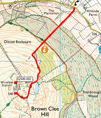
The route to the top is straightforward, just follow the track and enjoy.
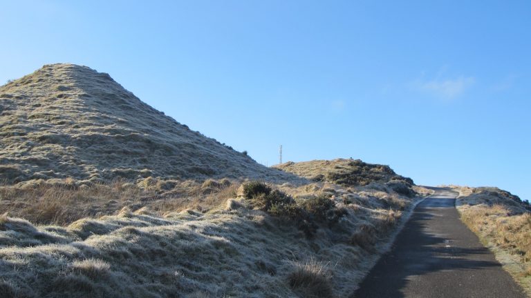
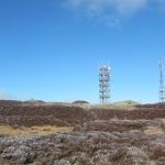
Once you get nearer the top you will probably notice the radio masts. There are some fairly high power signals transmitted that will play havoc with your front end.
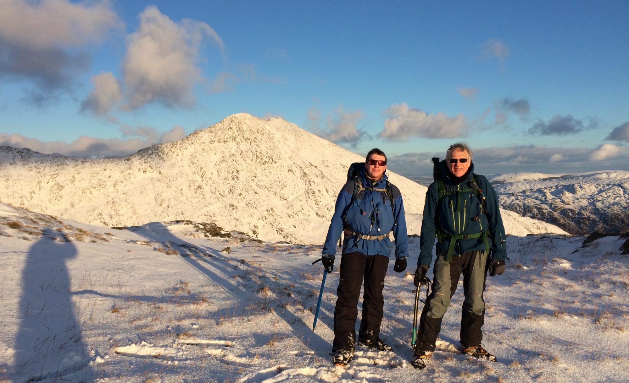
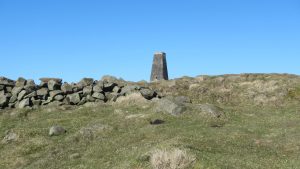
I set up my station alongside the summit marker, it’s not really a trig point although the remains of the old trig point seem to have been built into the path nearby.
Between the QRM I soon managed to make six contacts. Although the day was clear and sunny there was a lot of wind chill on the top so I didn’t hang around once I had worked everyone calling.
The return back to the car is as straightforward as the ascent and I was soon on my way to the next summit.
G/WB-002 Log
Journey Details
Date – 25th February 2018
Postcode – WV16 6TP
Parking – SO 602 877
Radio – Kenwood TH-D74 + 50W PA on 2m
Antenna – 2 ele dipole
Band – 144 FM
Contacts – 6
SOTA points – 2+3
Group – Myself
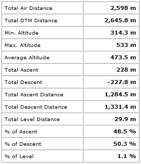
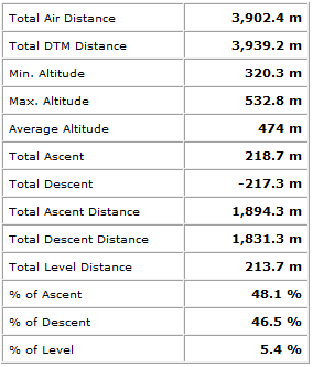
Walking Route Summary
G/WB-004 Titterstone Clee Hill
I had decided to attempt Titterstone Clee hill from the South West which with hindsight was perhaps not the best decision I ever made. Although the walking is fine, the parking is not. I managed to find a spot in the village which whilst it was safe and legal was not an ideal spot. What I hadn’t realised from the map was there is good parking at the viewing area to the South of the summit at SO 593 775. Next time I will try from there instead. Yes I know it’s obvious on the map now I know it’s there!
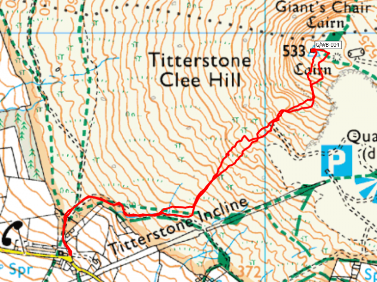
For anyone who wants to try this route, once you have found parking there is a good track up as far as the incline. This is the remains of an old narrow gauge railway built as part of the extensive quarrying activities which have taken place in the area.
It’s now just a grassy trackbed but still very obvious. From here there is no defined path to the top, the going is easy enough but it’s just a case of take a bearing and follow it.
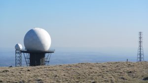
At the top there is a trig point and a small shelter to operate from but more significant is the large radar dome just off the top.
Either this or the radio masts alongside interfere quite a bit on VHF although not as bad as it was on Brown Clee hill earlier.
I set the station up between the trig point and the shelter as there was still quite a bit of wind chill. The summit seems quite popular and I had many visitors whilst I was there.
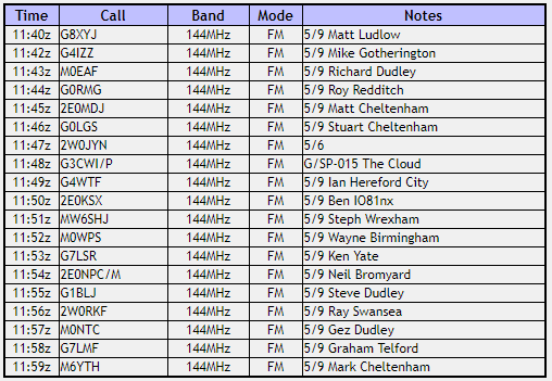
I’m not sure if it was the weather or the location but there was a lot of activity on the band and I made nineteen contacts before I managed to clear the pileup. I was glad of the limited shelter keeping me out of the wind.
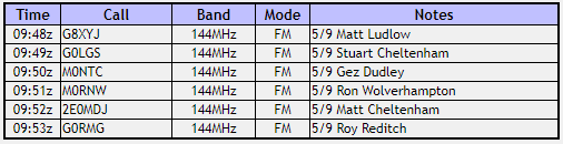
G/WB-004 Log
The return to the car is a straightforward reverse of the route up.
Journey Details
Date – 25th February 2018
Postcode – SY8 3NY
Parking – SO 584 773
Radio – Kenwood TH-D74 + 50W PA on 2m
Antenna – 2 ele dipole
Band – 144 FM
Contacts – 6
SOTA points – 2+3
Group – Myself
Walking Route Summary