After much planning and preparation I finally set foot in Ireland again late on the Thursday evening for an extended four day weekend climbing the SOTA summits of the Wicklow Mountains.
This is the story of that weekend and hopefully a useful catalogue for any one else planning a similar trip.
EI/IE-001, Lugnaquilla – 925m, 10 points
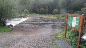 Known locally as ‘Lug’, fortunately for me as I am not sure I can pronounce the full name. The final remnants of storm Lorenzo was still blowing itself out across the North of Ireland as I arrived at the Baravore car park. The car park marks the end of the public highway although the road does continue North West through a ford. After the rain deposited by the storm crossing the ford would need a substantial vehicle.
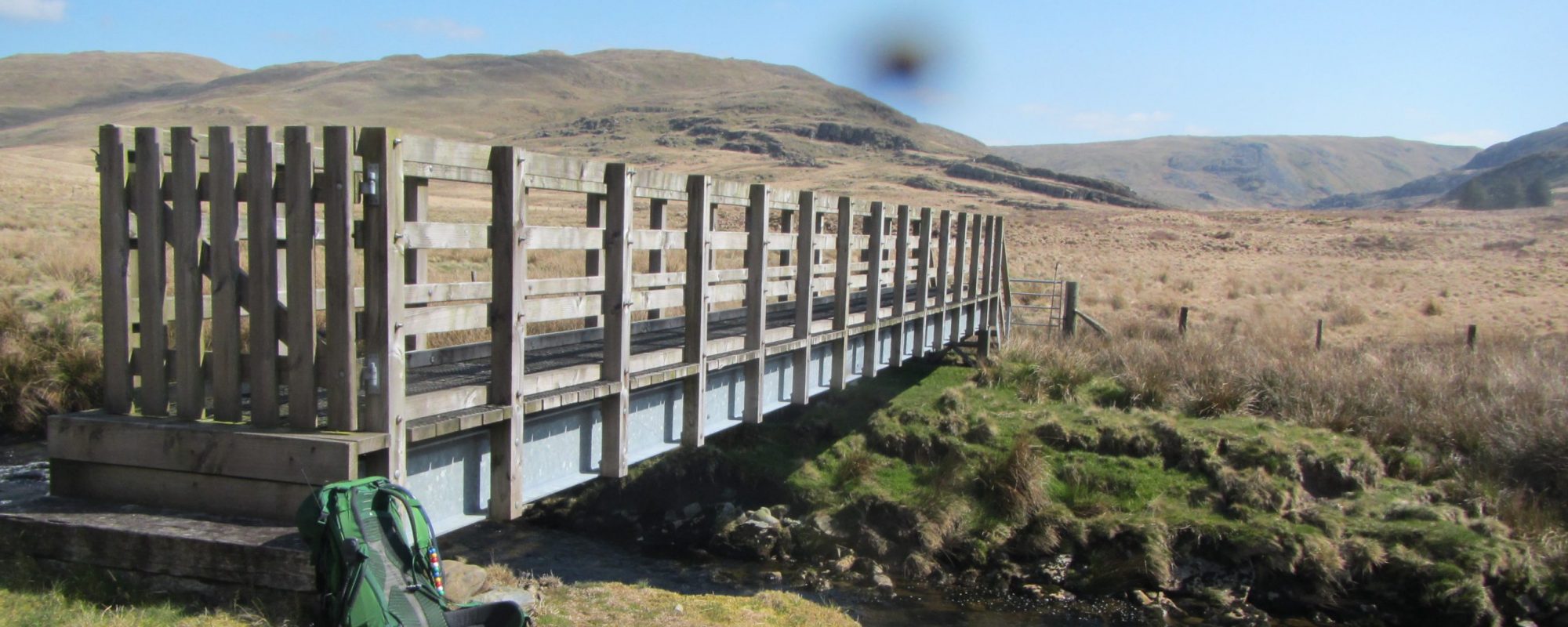
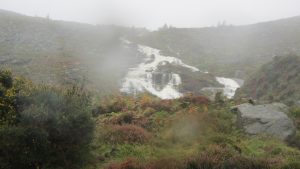
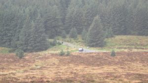
Fortunately there is a footbridge a few yards up river reached by following the path between the sign and the ford in the picture.
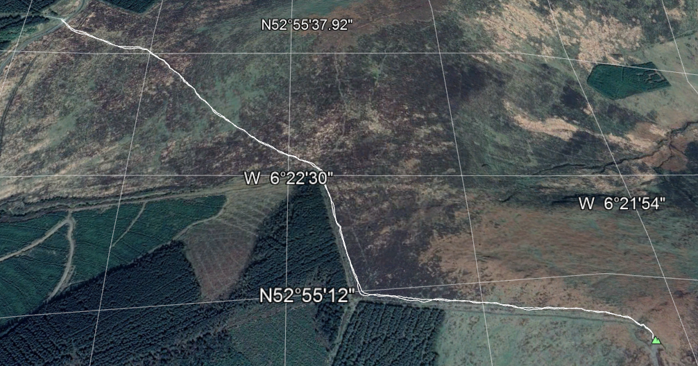
 Once over the footbridge there is a good path leading West into the large valley but beyond this the path appears and disappears, so unless it’s a clear day and you can see the top you will need to navigate your way to the top.
 The summit is surrounded by some fairly steep sections which are best avoided but on the other-hand the flatter sections are mostly peat bog and after heavy rain also best avoided! In particular the section around 650 metres was crossed by some fairly significant water which needs crossing with care.
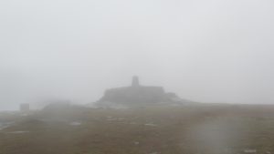 There is a good size summit on the top which was handy as the winds were still up around 60 mph on the day I was there, I managed to find enough shelter down behind the cairn and set up the station in the murk.
EI/IE-001, Lugnaquilla Log
Journey Details
Date – 4th October 2019
Parking (Grid) – T 064 941
Parking (Lat/Long) – 52.988030 -6.4129552
Radio – Kenwood TH-D74 + 50W PA
Antenna – 2 Element Yagi
Band – 144 FM
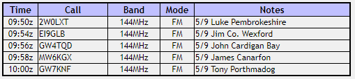
Contacts – 5
SOTA points – 10
Group – Myself
Distance – 12.7Km
Parking Height – 150m
Summit Height – 925m
Time Total – 4h 12m
Time Up 2h 02m
Time Down 1h 28m
EI/IE-010, Croaghanmoira – 664m, 8 points
Once back down from Lug I drove the few miles around to Croaghanmoira. By this time the water at the ford had risen considerably and the road back to Glenmalure was flooded in places but just passable still but more importantly the rain had finally stopped and the wind speed was dropping.
 From the parking spot there is a good clear track leading up to the summit. Compared to Lug it is an easy walk barely requiring reference to the map. The only difficult bit is climbing over the rather rickety gate,
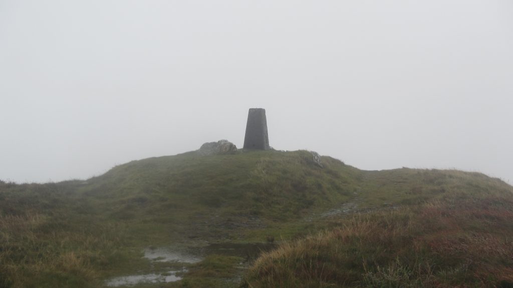
The trig point at the top clearly marks the summit and affords a convenient spot to set up the station.
EI/IE-010, Croaghanmoira – Log
Journey Details
Date – 4th October 2019
Parking (Grid) – T 087 876
Parking (Lat/Long) – 52.928613, -6.3835931
Radio – Kenwood TH-D74 + 50W PA
Antenna – 2 Element Yagi
Band – 144 FM
Contacts – 5
SOTA points – 8
Group – Myself
Distance – 3.7Km
Parking Height – 457m
Summit Height – 664m
Time Total – 1h 22m
Time Up 0h 32m
Time Down 0h 21m