After failing to activate these summits on our previous attempt over the bank holiday Peter and I decided to have another go at the route, slightly less ambitious this time. Having already activated Mynydd Mawr in May we chopped that one off the start and also skipped the couple of two pointers at the end to shorten the trip down to a manageable two days.
GW/NW-024, Trum y Ddysgl – 709m, 6 points
 Arriving at the Rhyd Ddu car park at about 7:30 pm we set off for our first night, camping below the impressive Y Garn crags. Note that the car park (SH 570 525) only allows you to buy tickets to cover the rest of the day, there is no multi-day or overnight option available. We bought three tickets for Friday and wrote on two of them “Sat” and “Sun” and displayed all three. A bit of a clue for any would be car thieves but we never had any problem with them or with the warden so it worked for us.
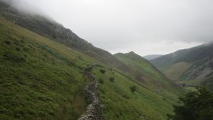
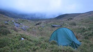
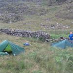
There is a good footpath linking the car park to the B4418 which we followed up past the reservoir to Bwlchgylfin. There is a stile of sorts here which will get you onto the access land and the end of the easy walking for now. Follow sheep trails and whatever you can find to work your way up and over the Clogwyn y Barcut ridge. 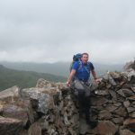 There is no stile over the wall top but it’s not difficult to climb. Once over the wall there is a path of sorts that will take you down into the Afon Tal-y-mignedd valley. This is where we set up camp for the night with a plentiful supply of fresh water flowing.
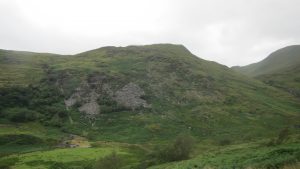
From camp we continued SW to pick up the ridge above Craig Trum y Ddysgl. There is no path we could find until near the top. It is a gruesome slog up the slope through thick undergrowth, mostly heather with fortunately very little gorse. As you near the top it will thin out to a pleasant round grassy summit.
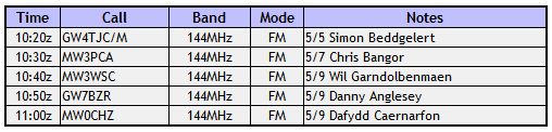
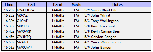
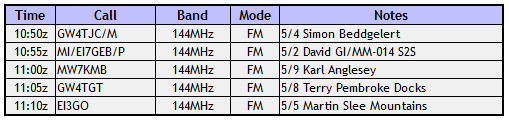
We set up the station on the summit and soon made seven contacts using my two element yagi. I was especially pleased with the last contact which was with Ken, G1NCG, just south of Swindon near our home town. This was a distance of around 150 miles. We were also glad to finally qualify this summit after failing on our last attempt due to bad weather.
GW/NW-024 Log
GW/NW-020, Craig Cwm Silyn – 734m, 6 points
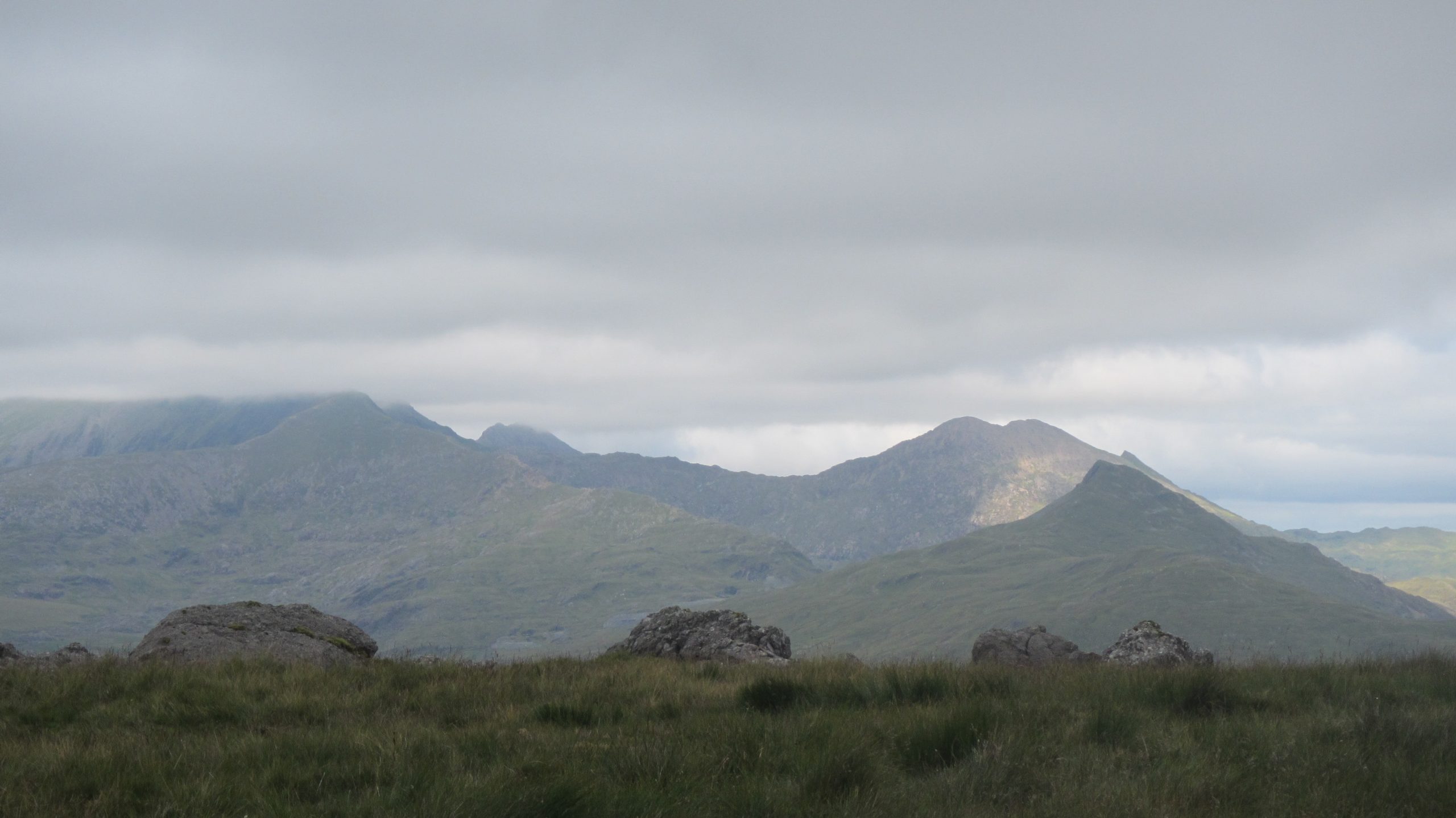
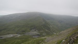
 The walk from Trum y Ddysgl to Craig Cwm Silyn was probably the highlight of the day. Even though it was mostly in cloud it was quite dramatic with some lovely ridge walking along reasonable paths.
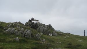
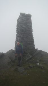 There is an interesting obelisk half way between the two summits at Mynydd Tal-y-mignedd. This was apparently put up to commemorate Queen Victoria’s Diamond Jubilee.
As you approach Craig Cwm Silyn there is an interesting section of crags at Craig Pennant. This is almost a grade one scramble and makes a nice distraction on the ascent but is easily climbed with a bit of care.
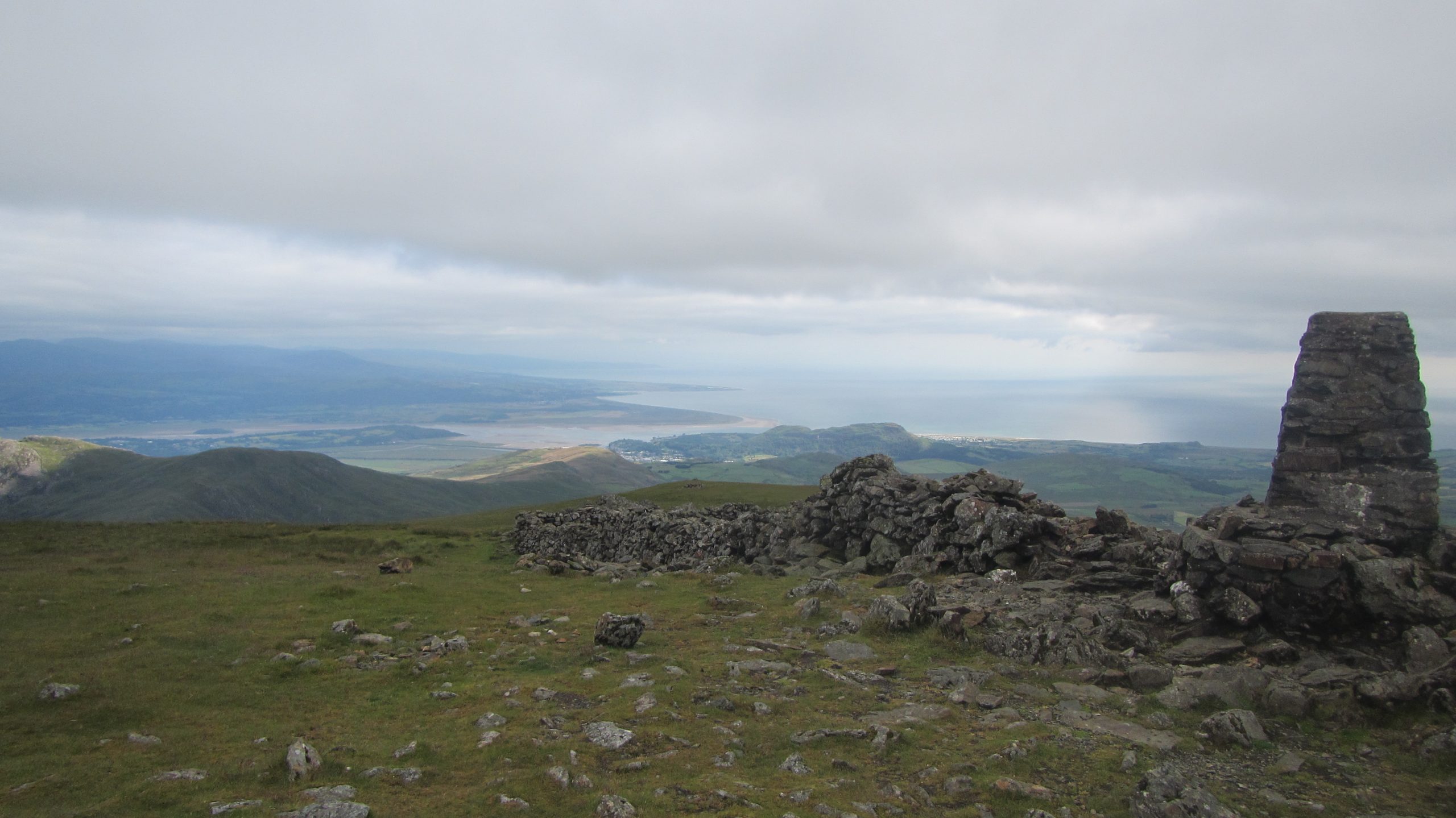
 On reaching the summit of Craig Cwm Silyn you will be pleased to find a summit shelter complete with built in furniture to sit on.
We set up the station in the shelter, I again used the two element yagi and were soon rewarded with five contacts in the log.
GW/NW-020 Log
GW/NW-014, Moel Hebog – 783m, 6 points
After the pleasures of walking from Trum y Ddysgl to Craig Cwm Silyn, the route we took from Craig Cwm Silyn to Moel Hebog was hard work but had it’s own rewards.
We chose to drop off to the SE following a wall down near the ridge line. In the cloud this involved some carefull navigation but once the wall was found it was easy enough to follow down until we reached the lower sections which are very steep on a loose surface.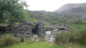
With hindsight this was perhaps not the best option to descend and next time I will probably try and find a high route back around past the Obelisk. Once down though there is a pleasant picnic area at the end of the road at SH 540 492 where we had lunch. From here there is a 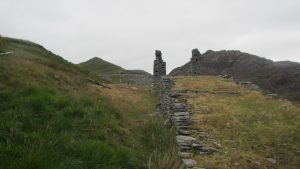 navigationally challenging section until you pick up the old inclines leading to the disused quarry.
The quarry must have been a scene of intense activity in the past but slowly nature is taming it and restoring the ugly industrial past 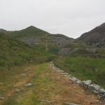 back to something more pleasant to walk through. I am sure there is a lot of history encapsulated in this small valley. Passing out of the quarry and on up the Bwalch Cwm-trwsgl there is a good path now all the way to the top of Moel Hebog. There is a spring just before you ascend Craig Cwm-trwsgl. If you are short of water it would be wise to fill up here as there is nothing on the top until you descend from Hebog on the other side.
On the summit of Moel Hebog we set up the stations and soon had eight contacts in the log using the yagi once again.
GW/NW-014 Log
GW/NW-019, Yr Aran – 747m, 6 points
 From the summit of Moel Hebog find the path down towards Beddgelert to the NE . It’s a bit craggy in places but perfectly passable. We chose to spend the night near an old settlement beside the Afon Glochig to the North of the path before descending into Beddgelert in the morning.
Turn left under the railway as you enter the village, this path will take you to the main A4085 where you will turn left again heading NW out of the village. 430m along the road there is a track on the right heading N for 150m to pick up the footpath. Here the track continues clearly in the direction you want, but it is signposted informing that it’s not a public footpath so we turned E on the RoW then found an unmarked path leading up and onto the access land. From here it’s a slog through undergrowth until the original track is regained. Follow the track to the end and then navigate on a bearing until reaching the slope of Yr Aran. Enjoy the view of the nice footpath back down in the distance if it’s a clear day!
The final push up onto the top of Yr Aran makes a nice change with a good path to follow.
At the top we set up the stations, this time I decided to use the MFJ LongRanger antenna as I had carried it all weekend. It didn’t take long to put five entries in the log, including a S2S into Northern Ireland which was a nice bonus.
GW/NW-019 Log
From the top of Yr Arran there is a path off to the North which decends and meets up with the Snowden path out of Rhyd Ddu. Once down onto this it’s an easy walk out back down to the station car park in Rhyd Ddu.
Journey Details
Date – 13th/14th July 2019
Postcode – LL54 6TN
Parking – SH 571 525
Radio – Kenwood TH-D74
Antenna – Long ranger & 2 Element Yagi
Band – 144 FM
Contacts – 7 + 5 + 8 + 5
SOTA points – 6 + 6 + 6 + 6
Group – Myself and Peter M6XPE
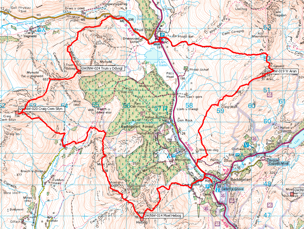
Walking Route Summary
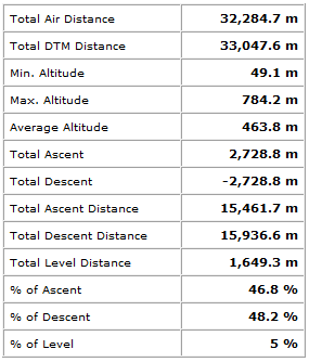
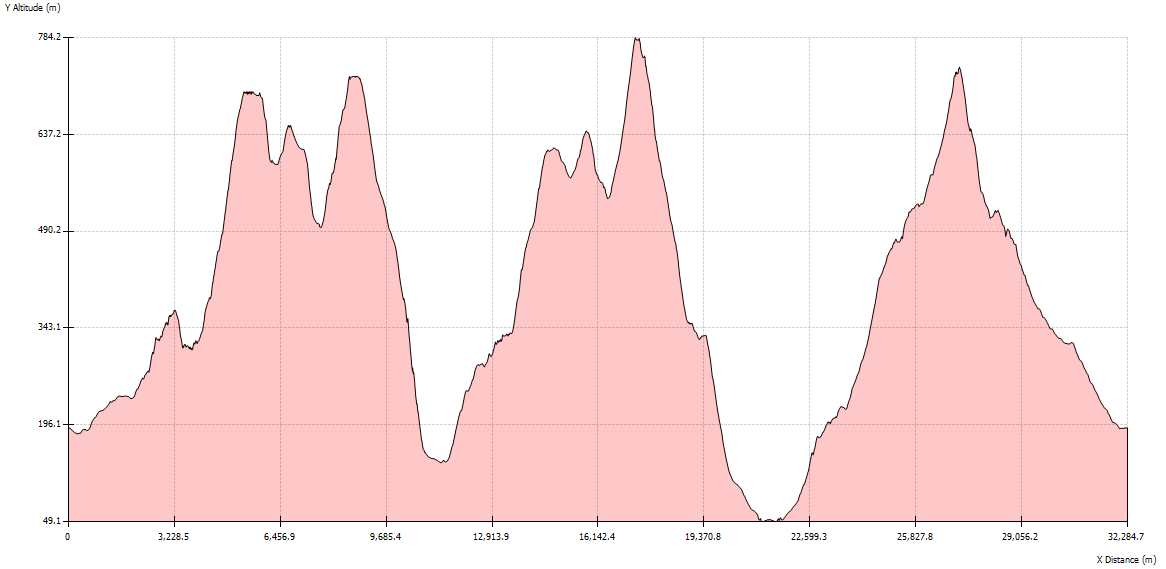
Profile